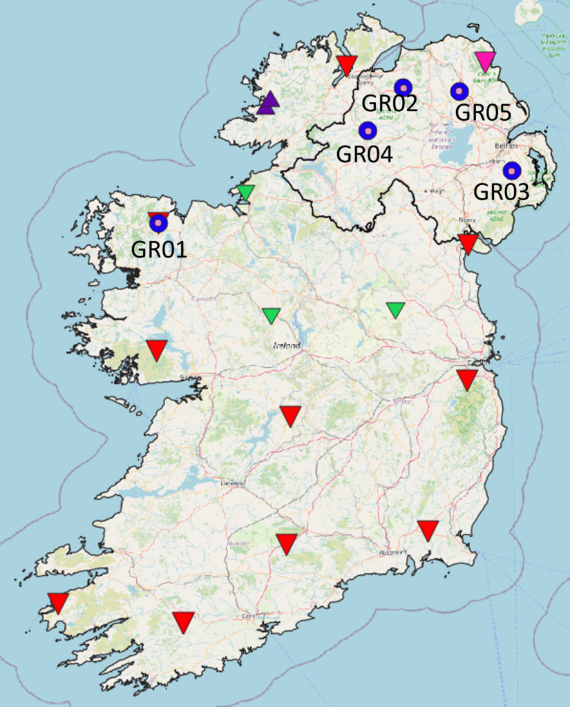
GRANNUS and MOD3LTHERM Seismic Network
GRANNUS is an array of 6 seismometers in the north of the island of Ireland, operated by the Dublin Institute for Advanced Studies in collaboration with the Irish National Seismic Network, Geological Survey of Northern Ireland and Geological Survey Ireland. There are 6 broadband Nanometrics Trillium-120 PA seismometers with DIGOS Cube data loggers. The stations were installed in May and June 2023 and June 2024 and will run continuously for 2 years. GRANNUS adds to the seismic station coverage in Northern Ireland and in the north of the Republic of Ireland. The data will be used to improve lithospheric scale subsurface imaging of Ireland and determine areas of high geothermal potential, in addition to seismicity analysis.
Click here to access the FDSN page for more details.
This dataset has emanated from research supported in part by a research grant from Science Foundation Ireland and the Sustainable Energy Authority of Ireland under the SFI-IRC Pathway Programme 22/PATHS/10676 and the Sustainable Energy Authority of Ireland under the SEAI Research and Development & Demonstration Funding Programme 2022, Grant number 2022/RDD/782.

